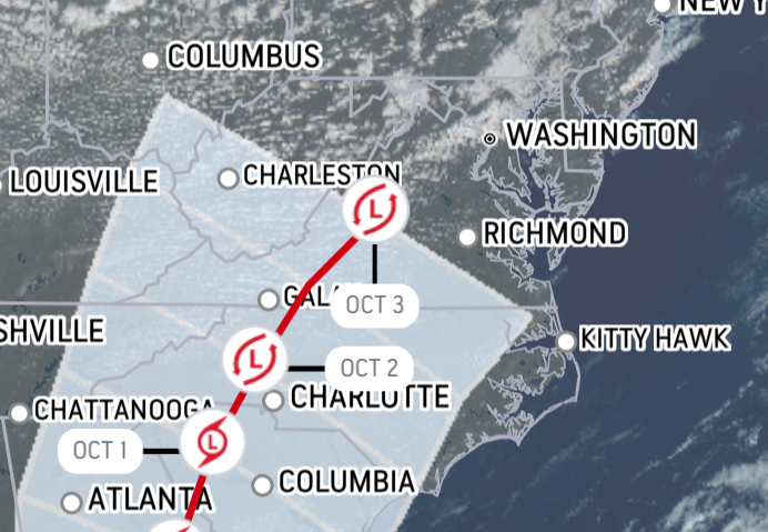
Hurricane Ian is still on a track that will eventually take it to Maryland, Washington, D.C. and Northern Virginia, according to a model posted by Accuweather.com. The newest update shows the storm making its turn toward the Atlantic Ocean at a slightly later point than predicted earlier, with the center of the storm now passing north of Washington and more directly over Baltimore, before heading out to sea over Atlantic City. This track is subject to change from many variables.

Accuweather forecasts the storm arriving in the Mid-Atlantic on Sunday or Monday. It predicts Ian will drop about an inch of rain on our area by the time it moves off to the Atlantic.

Earlier this hour, the National Hurricane Center reported that Hurricane Ian's current location is 75 miles WSW of Naples, Florida, and has strengthened into a Category 4 hurricane. It is moving north-northeast at 10 MPH. Maximum sustained winds are near 140 MPH, with gusts over 140 MPH. Landall on the Gulf Coast of Florida is expected this afternoon, according to ABC News.
Graphics courtesy Accuweather.com