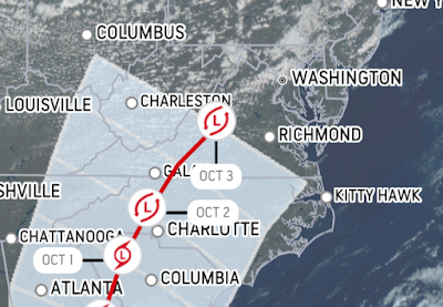
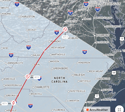
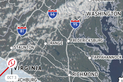
Hurricane Ian's current location is 325 miles south-southwest of Key West, Florida, according to the National Hurricane center. But after Ian hits the Gulf Coast of Florida - currently anticipated to occur Thursday - as a potential Category 4 storm upon landfall, will its path ultimately affect the Washington, D.C. area, including Rockville and Montgomery County in Maryland? Accuweather's latest track shows a very good chance that it will.
The last position forecast on the map at this time predicts Ian will pass east of Atlanta, west of Charlotte, and be aimed directly at the Washington, D.C. area as it arcs back toward the Atlantic Ocean. At that position on October 3, 2022, Accuweather shows Ian directly north of Lynchburg, Virginia. Extending the path from that point on the same curvature would show the remnants of Ian making a direct hit on the Washington, D.C. area. Accuweather predicts Ian will have maximum sustained wind gusts of 35 MPH as of that time, and maximum wind gusts of up to 46 MPH - certainly well below hurricane-force winds, but still a risk for downed trees and power lines.
Of course, forecasters can't even guarantee the exact point where Ian will make landfall in Florida yet, so much of this model's track could easily change. But what it does show is that there are strong odds the storm will greatly impact our area for at least one day next week, with the potential for high winds, heavy rain, flooding and tornadic activity. Now is the time to think ahead, and ensure you have batteries, a half-tank of gas in your car, some extra non-perishable food on hand if power goes out, and a battery-powered radio.
Images courtesy of Accuweather.com


So much for outdoor festivals next weekend.
ReplyDelete